
Homestead topographic map
Interactive map
Click on the map to display elevation.
About this map
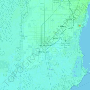
Name: Homestead topographic map, elevation, terrain.
Location: Homestead, Miami-Dade County, Florida, 33030, United States (25.31189 -80.63599 25.63189 -80.31599)
Average elevation: 10 ft
Minimum elevation: -7 ft
Maximum elevation: 154 ft
Other topographic maps
Click on a map to view its topography, its elevation and its terrain.
Leisure City
United States > Florida > Miami-Dade County > Homestead > Leisure Mobile Home Park-Modello Park
Leisure City, Leisure Mobile Home Park-Modello Park, Homestead, Miami-Dade County, Florida, United States
Average elevation: 13 ft