
Harveyville topographic map
Interactive map
Click on the map to display elevation.
About this map
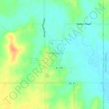
Name: Harveyville topographic map, elevation, terrain.
Location: Harveyville, Wabaunsee County, Kansas, United States (38.78606 -95.96952 38.79322 -95.95882)
Average elevation: 1,152 ft
Minimum elevation: 1,102 ft
Maximum elevation: 1,237 ft