
Leupp topographic map
Interactive map
Click on the map to display elevation.
About this map
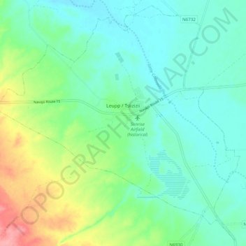
Name: Leupp topographic map, elevation, terrain.
Average elevation: 4,764 ft
Minimum elevation: 4,669 ft
Maximum elevation: 5,020 ft
Other topographic maps
Click on a map to view its topography, its elevation and its terrain.
Diablo Canyon
United States > Arizona > Coconino County > Leupp
Diablo Canyon, Leupp, Western Navajo Agency, Coconino County, Arizona, United States
Average elevation: 5,289 ft