
Long Hill Township topographic map
Interactive map
Click on the map to display elevation.
About this map
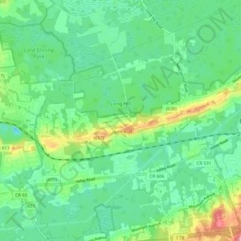
Name: Long Hill Township topographic map, elevation, terrain.
Location: Long Hill Township, Morris County, New Jersey, United States (40.64952 -74.53439 40.71741 -74.44376)
Average elevation: 253 ft
Minimum elevation: 141 ft
Maximum elevation: 541 ft