
Washburn topographic map
Interactive map
Click on the map to display elevation.
About this map
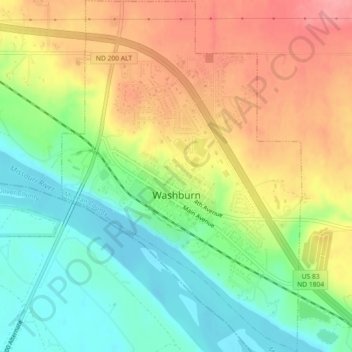
Name: Washburn topographic map, elevation, terrain.
Average elevation: 1,781 ft
Minimum elevation: 1,640 ft
Maximum elevation: 1,939 ft
Other topographic maps
Click on a map to view its topography, its elevation and its terrain.
Wilton
United States > North Dakota > McLean County
Wilton, McLean County, North Dakota, United States
Average elevation: 2,159 ft
Riverdale
United States > North Dakota > McLean County > Riverdale
Riverdale, McLean County, North Dakota, 58565, United States
Average elevation: 1,923 ft