
West Fairlee topographic map
Interactive map
Click on the map to display elevation.
About this map
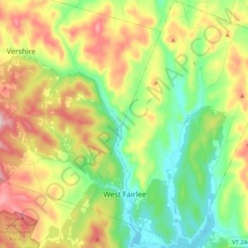
Name: West Fairlee topographic map, elevation, terrain.
Location: West Fairlee, Orange County, Vermont, 05083, United States (43.88634 -72.28449 43.99276 -72.16782)
Average elevation: 1,243 ft
Minimum elevation: 666 ft
Maximum elevation: 2,142 ft