
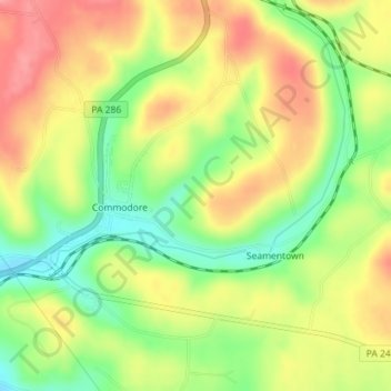
Commodore topographic map
Interactive map
Click on the map to display elevation.
About this map
Name: Commodore topographic map, elevation, terrain.
Average elevation: 1,558 ft
Minimum elevation: 1,385 ft
Maximum elevation: 1,719 ft
Other topographic maps
Click on a map to view its topography, its elevation and its terrain.
Starford
United States > Pennsylvania > Indiana County > Green Township
Starford, Green Township, Indiana County, Pennsylvania, 15777, United States
Average elevation: 1,535 ft
Green Township
United States > Pennsylvania > Indiana County > Green Township
Green Township, Indiana County, Pennsylvania, United States
Average elevation: 1,624 ft