
Mount Baldy topographic map
Interactive map
Click on the map to display elevation.
About this map
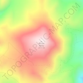
Name: Mount Baldy topographic map, elevation, terrain.
Location: Mount Baldy, Granite County, Montana, United States (46.73794 -113.42041 46.73804 -113.42031)
Average elevation: 6,047 ft
Minimum elevation: 4,954 ft
Maximum elevation: 6,906 ft
Other topographic maps
Click on a map to view its topography, its elevation and its terrain.
Hall
United States > Montana > Granite County
Hall, Granite County, Montana, 59837, United States
Average elevation: 4,236 ft
Philipsburg
United States > Montana > Granite County
Philipsburg, Granite County, Montana, United States
Average elevation: 5,404 ft