
Marrowbone topographic map
Interactive map
Click on the map to display elevation.
About this map
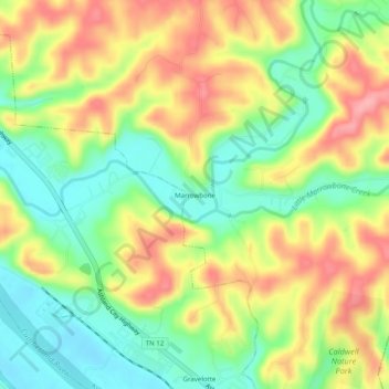
Name: Marrowbone topographic map, elevation, terrain.
Location: Marrowbone, Cheatham County, Tennessee, United States (36.22311 -87.02695 36.26311 -86.98695)
Average elevation: 548 ft
Minimum elevation: 374 ft
Maximum elevation: 745 ft