
Bridge Meadow Brook topographic map
Interactive map
Click on the map to display elevation.
About this map
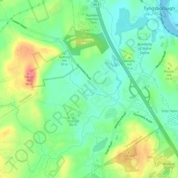
Name: Bridge Meadow Brook topographic map, elevation, terrain.
Average elevation: 197 ft
Minimum elevation: 92 ft
Maximum elevation: 387 ft
Other topographic maps
Click on a map to view its topography, its elevation and its terrain.
Lake Mascuppic
United States > Massachusetts > Middlesex County > Tyngsborough > Willowdale
Lake Mascuppic, Willowdale, Tyngsborough, Middlesex County, Massachusetts, United States
Average elevation: 187 ft