
Aksaray topographic map
Interactive map
Click on the map to display elevation.
About this map
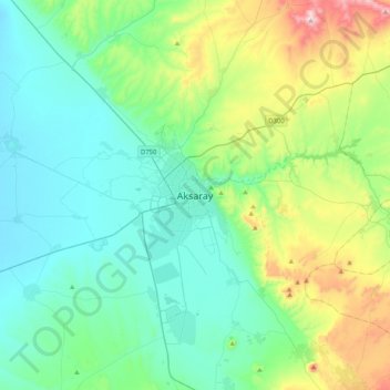
Name: Aksaray topographic map, elevation, terrain.
Average elevation: 3,533 ft
Minimum elevation: 3,041 ft
Maximum elevation: 5,253 ft
Aksaray (pronounced ) is a city in the Central Anatolia region of Turkey and the capital district of Aksaray Province. According to 2009 census figures, the population of the province is 376 907 of which 171,423 live in the city of Aksaray. The district covers an area of 4,589 km2 (1,772 sq mi), and the average elevation is 980 m (3,215 ft), with the highest point being Mt. Hasan at 3,253 m (10,673 ft).