
Prądy topographic map
Interactive map
Click on the map to display elevation.
About this map
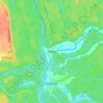
Name: Prądy topographic map, elevation, terrain.
Average elevation: 400 ft
Minimum elevation: 331 ft
Maximum elevation: 538 ft
Other topographic maps
Click on a map to view its topography, its elevation and its terrain.
Steinforth
Polen > Woiwodschaft Pommern > powiat człuchowski > Steinforth
Steinforth, gmina Koczała, powiat człuchowski, Woiwodschaft Pommern, 77-220, Polen
Average elevation: 561 ft