
Lost River topographic map
Interactive map
Click on the map to display elevation.
About this map
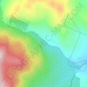
Name: Lost River topographic map, elevation, terrain.
Average elevation: 2,060 ft
Minimum elevation: 1,014 ft
Maximum elevation: 3,783 ft
Other topographic maps
Click on a map to view its topography, its elevation and its terrain.
Mount Jim
USA > New Hampshire > Woodstock
Mount Jim, Woodstock, Grafton County, New Hampshire, USA
Average elevation: 3,530 ft