
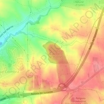
Húmera topographic map
Interactive map
Click on the map to display elevation.
About this map
Name: Húmera topographic map, elevation, terrain.
Average elevation: 2,090 ft
Minimum elevation: 1,909 ft
Maximum elevation: 2,208 ft
Other topographic maps
Click on a map to view its topography, its elevation and its terrain.
Móstoles
España > Comunidad de Madrid > Móstoles
Móstoles, Área metropolitana de Madrid y Corredor del Henares, Comunidad de Madrid, 28931, España
Average elevation: 2,103 ft