
Ali Mendjeli topographic map
Interactive map
Click on the map to display elevation.
About this map
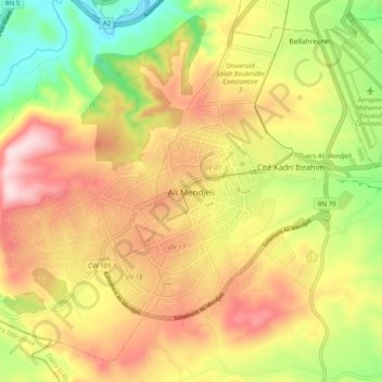
Name: Ali Mendjeli topographic map, elevation, terrain.
Average elevation: 2,451 ft
Minimum elevation: 1,850 ft
Maximum elevation: 3,018 ft
Other topographic maps
Click on a map to view its topography, its elevation and its terrain.
El Khroub
Algeria > Constantine > El Khroub District
El Khroub, El Khroub District, Constantine, Algeria
Average elevation: 2,523 ft