
Ciwidey topographic map
Interactive map
Click on the map to display elevation.
About this map
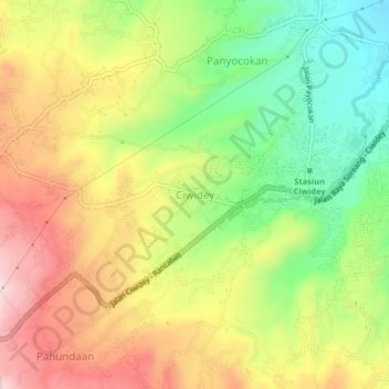
Name: Ciwidey topographic map, elevation, terrain.
Location: Ciwidey, West Java, Indonesia (-7.12389 107.43364 -7.08389 107.47364)
Average elevation: 3,898 ft
Minimum elevation: 3,389 ft
Maximum elevation: 4,426 ft