
Bellona Island topographic map
Interactive map
Click on the map to display elevation.
About this map
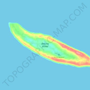
Name: Bellona Island topographic map, elevation, terrain.
Average elevation: 23 ft
Minimum elevation: 0 ft
Maximum elevation: 266 ft
Other topographic maps
Click on a map to view its topography, its elevation and its terrain.
Rennell Island
Solomon Islands > Rennell and Bellona Province
Rennell Island, Rennell and Bellona Province, Solomon Islands
Average elevation: 20 ft
Rennell and Bellona Province
Solomon Islands > Rennell and Bellona Province
Rennell and Bellona Province, Solomon Islands
Average elevation: 3 ft