
Spechtensee topographic map
Interactive map
Click on the map to display elevation.
About this map
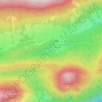
Name: Spechtensee topographic map, elevation, terrain.
Average elevation: 3,904 ft
Minimum elevation: 2,871 ft
Maximum elevation: 4,925 ft
Other topographic maps
Click on a map to view its topography, its elevation and its terrain.
Grimming
Austria > Styria > Stainach-Pürgg
Grimming, Stainach-Pürgg, Liezen, Styria, 8950, Austria
Average elevation: 5,495 ft