
Koksijde topographic map
Interactive map
Click on the map to display elevation.
About this map
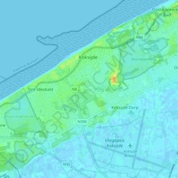
Name: Koksijde topographic map, elevation, terrain.
Location: Koksijde, Veurne, West Flanders, Flanders, 8670, Belgium (51.08351 2.60178 51.13500 2.66917)
Average elevation: 13 ft
Minimum elevation: -7 ft
Maximum elevation: 89 ft
Other topographic maps
Click on a map to view its topography, its elevation and its terrain.
Oostduinkerke
Belgium > West Flanders > Veurne > Koksijde
Oostduinkerke, Koksijde, Veurne, West Flanders, Flanders, Belgium
Average elevation: 10 ft