
Lages topographic map
Interactive map
Click on the map to display elevation.
About this map
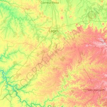
Name: Lages topographic map, elevation, terrain.
Location: Lages, Santa Catarina, South Region, Brazil (-28.43351 -50.69641 -27.56914 -49.99821)
Average elevation: 3,317 ft
Minimum elevation: 2,064 ft
Maximum elevation: 5,646 ft