
North Chatham topographic map
Interactive map
Click on the map to display elevation.
About this map
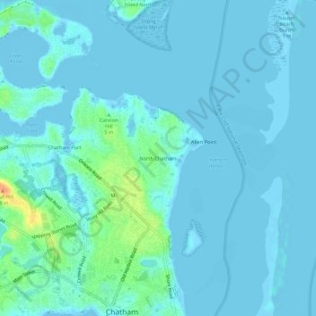
Name: North Chatham topographic map, elevation, terrain.
Average elevation: 16 ft
Minimum elevation: -16 ft
Maximum elevation: 125 ft
Other topographic maps
Click on a map to view its topography, its elevation and its terrain.
Monomoy Point
United States > Massachusetts > Barnstable County > Chatham
Monomoy Point, Chatham, Barnstable County, Massachusetts, United States
Average elevation: 0 ft
South Chatham
United States > Massachusetts > Barnstable County > Chatham > South Chatham
South Chatham, Chatham, Barnstable County, Massachusetts, 02659, United States
Average elevation: 30 ft