
Mönchengladbach topographic map
Interactive map
Click on the map to display elevation.
About this map
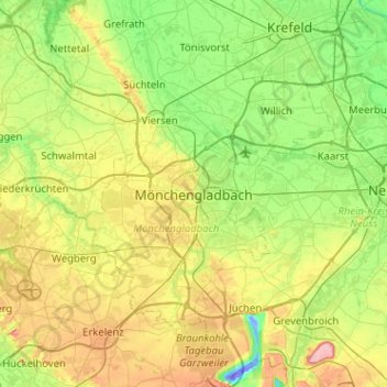
Name: Mönchengladbach topographic map, elevation, terrain.
Location: Mönchengladbach, North Rhine-Westphalia, 41061, Germany (51.03470 6.27536 51.35470 6.59536)
Average elevation: 194 ft
Minimum elevation: -154 ft
Maximum elevation: 594 ft
Other topographic maps
Click on a map to view its topography, its elevation and its terrain.
Rheindahlen
Germany > North Rhine-Westphalia > Mönchengladbach > Rheindahlen
Rheindahlen, Mönchengladbach, North Rhine-Westphalia, 41179, Germany
Average elevation: 246 ft