
Hyden topographic map
Interactive map
Click on the map to display elevation.
About this map
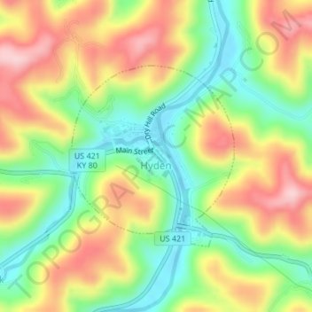
Name: Hyden topographic map, elevation, terrain.
Location: Hyden, Leslie County, Kentucky, United States (37.15386 -83.38243 37.16954 -83.36474)
Average elevation: 1,155 ft
Minimum elevation: 827 ft
Maximum elevation: 1,532 ft
Other topographic maps
Click on a map to view its topography, its elevation and its terrain.
Bobs Fork
United States > Kentucky > Leslie County
Bobs Fork, Leslie County, Kentucky, 41714, United States
Average elevation: 1,230 ft
Yeaddiss
United States > Kentucky > Leslie County
Yeaddiss, Leslie County, Kentucky, 41777, United States
Average elevation: 1,598 ft
Buckhorn Lake
United States > Kentucky > Leslie County
Buckhorn Lake, Leslie County, Kentucky, United States
Average elevation: 1,155 ft