Spring Valley topographic map
Interactive map
Click on the map to display elevation.
About this map
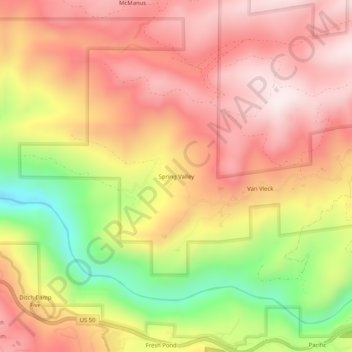
Name: Spring Valley topographic map, elevation, terrain.
Average elevation: 3,789 ft
Minimum elevation: 2,533 ft
Maximum elevation: 4,606 ft

Click on the map to display elevation.
Name: Spring Valley topographic map, elevation, terrain.
Average elevation: 3,789 ft
Minimum elevation: 2,533 ft
Maximum elevation: 4,606 ft