
Riveredge Park topographic map
Interactive map
Click on the map to display elevation.
About this map
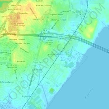
Name: Riveredge Park topographic map, elevation, terrain.
Location: Riveredge Park, New Castle County, Delaware, DE 19720, USA (39.66900 -75.56826 39.70900 -75.52826)
Average elevation: 26 ft
Minimum elevation: -10 ft
Maximum elevation: 89 ft