
Lahti topographic map
Interactive map
Click on the map to display elevation.
About this map
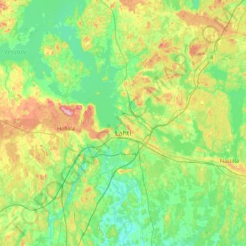
Name: Lahti topographic map, elevation, terrain.
Average elevation: 344 ft
Minimum elevation: 203 ft
Maximum elevation: 719 ft
Other topographic maps
Click on a map to view its topography, its elevation and its terrain.
Lahti
Finland > Päijät-Häme > Lahti
Lahti, Lahden seutukunta, Päijät-Häme, Southern Finland, Mainland Finland, 15100, Finland
Average elevation: 341 ft