
Schierke topographic map
Interactive map
Click on the map to display elevation.
About this map
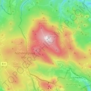
Name: Schierke topographic map, elevation, terrain.
Average elevation: 2,320 ft
Minimum elevation: 1,030 ft
Maximum elevation: 3,747 ft
Other topographic maps
Click on a map to view its topography, its elevation and its terrain.
Brocken
Germany > Saxony-Anhalt > Landkreis Harz > Wernigerode
Brocken, Wernigerode, Landkreis Harz, Saxony-Anhalt, Germany
Average elevation: 3,159 ft