
Lautém topographic map
Interactive map
Click on the map to display elevation.
About this map
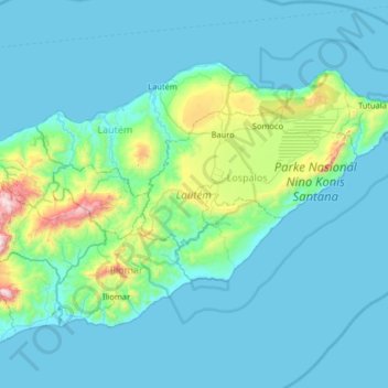
Name: Lautém topographic map, elevation, terrain.
Location: Lautém, East Timor (-8.96163 126.61002 -8.19645 127.54415)
Average elevation: 194 ft
Minimum elevation: 0 ft
Maximum elevation: 3,793 ft
Other topographic maps
Click on a map to view its topography, its elevation and its terrain.
Margem de rio
East Timor > Viqueque > Viqueque
Margem de rio, Viqueque, East Timor
Average elevation: 827 ft