
Waimea topographic map
Interactive map
Click on the map to display elevation.
About this map
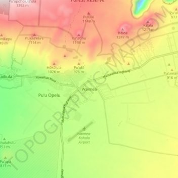
Name: Waimea topographic map, elevation, terrain.
Location: Waimea, Hawaiʻi County, Hawaii, USA (19.98045 -155.70391 20.06045 -155.62391)
Average elevation: 2,953 ft
Minimum elevation: 1,519 ft
Maximum elevation: 4,452 ft