
Ilha Graciosa topographic map
Interactive map
Click on the map to display elevation.
About this map
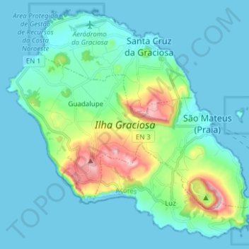
Name: Ilha Graciosa topographic map, elevation, terrain.
Average elevation: 213 ft
Minimum elevation: 0 ft
Maximum elevation: 1,312 ft
The interior of the island is generally flat and dotted by numerous volcanic cones, with a southern portion of the island higher in altitude. The island is divided into four geomorphological zones: