
Figheldean topographic map
Interactive map
Click on the map to display elevation.
About this map
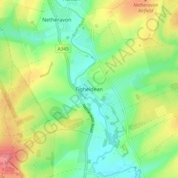
Name: Figheldean topographic map, elevation, terrain.
Average elevation: 338 ft
Minimum elevation: 236 ft
Maximum elevation: 492 ft
Other topographic maps
Click on a map to view its topography, its elevation and its terrain.
Barrow Clump
United Kingdom > England > Figheldean
Barrow Clump, Milston Road, Figheldean, Wiltshire, South West England, England, SP4 8HR, United Kingdom
Average elevation: 331 ft