
Luanda topographic map
Interactive map
Click on the map to display elevation.
About this map
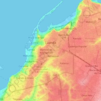
Name: Luanda topographic map, elevation, terrain.
Location: Luanda, Municipality of Luanda, Luanda Province, Angola (-8.92083 13.17323 -8.75923 13.31086)
Average elevation: 144 ft
Minimum elevation: -7 ft
Maximum elevation: 328 ft