
Olfen topographic map
Interactive map
Click on the map to display elevation.
About this map
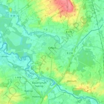
Name: Olfen topographic map, elevation, terrain.
Location: Olfen, Kreis Coesfeld, North Rhine-Westphalia, 59399, Germany (51.66470 7.29878 51.74289 7.45175)
Average elevation: 184 ft
Minimum elevation: 125 ft
Maximum elevation: 354 ft