
Bangor topographic map
Interactive map
Click on the map to display elevation.
About this map
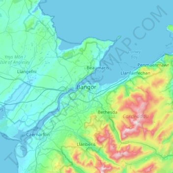
Name: Bangor topographic map, elevation, terrain.
Location: Bangor, Gwynedd, Wales, LL57 1DR, United Kingdom (53.06772 -4.28688 53.38772 -3.96688)
Average elevation: 489 ft
Minimum elevation: -3 ft
Maximum elevation: 3,471 ft