
Trois-Rivières topographic map
Interactive map
Click on the map to display elevation.
About this map
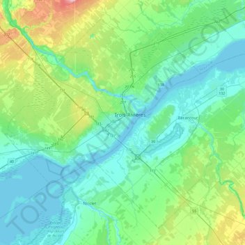
Name: Trois-Rivières topographic map, elevation, terrain.
Location: Trois-Rivières, Mauricie, Quebec, G9A 4M3, Canada (46.17271 -72.71646 46.49271 -72.39646)
Average elevation: 121 ft
Minimum elevation: 3 ft
Maximum elevation: 594 ft