
Grefrath topographic map
Interactive map
Click on the map to display elevation.
About this map
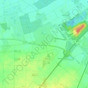
Name: Grefrath topographic map, elevation, terrain.
Average elevation: 174 ft
Minimum elevation: 121 ft
Maximum elevation: 276 ft
Other topographic maps
Click on a map to view its topography, its elevation and its terrain.
Holzheim
Germany > North Rhine-Westphalia > Neuss
Holzheim, Neuss, Rhein-Kreis Neuss, Regierungsbezirk Düsseldorf, North Rhine-Westphalia, 41472, Germany
Average elevation: 161 ft