
Corozal District topographic map
Interactive map
Click on the map to display elevation.
About this map
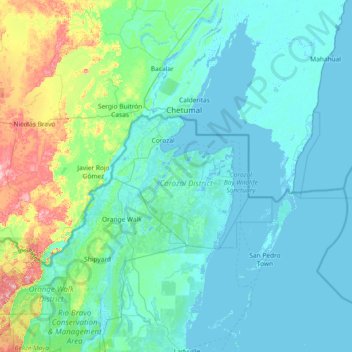
Name: Corozal District topographic map, elevation, terrain.
Location: Corozal District, Belize (17.55000 -89.03333 18.95000 -87.63333)
Average elevation: 85 ft
Minimum elevation: -13 ft
Maximum elevation: 745 ft
Other topographic maps
Click on a map to view its topography, its elevation and its terrain.