
Schöllkrippen topographic map
Interactive map
Click on the map to display elevation.
About this map
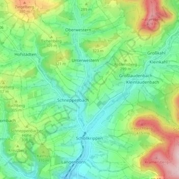
Name: Schöllkrippen topographic map, elevation, terrain.
Location: Schöllkrippen, Landkreis Aschaffenburg, Bavaria, 63825, Germany (50.07499 9.19885 50.12199 9.27887)
Average elevation: 915 ft
Minimum elevation: 640 ft
Maximum elevation: 1,499 ft