
Aschaffenburg topographic map
Interactive map
Click on the map to display elevation.
About this map
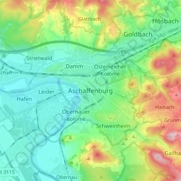
Name: Aschaffenburg topographic map, elevation, terrain.
Location: Aschaffenburg, Bavaria, 63739, Germany (49.93405 9.10936 50.01405 9.18936)
Average elevation: 568 ft
Minimum elevation: 341 ft
Maximum elevation: 1,132 ft