
Mashiki topographic map
Interactive map
Click on the map to display elevation.
About this map
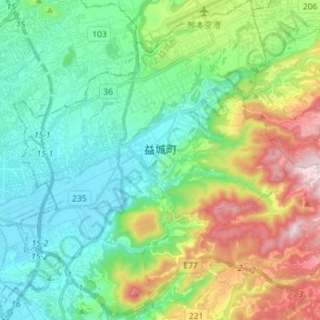
Name: Mashiki topographic map, elevation, terrain.
Location: Mashiki, Kamimashiki County, Kumamoto Prefecture, Japan (32.73119 130.77811 32.84007 130.88997)
Average elevation: 499 ft
Minimum elevation: 7 ft
Maximum elevation: 1,657 ft