
Glover topographic map
Interactive map
Click on the map to display elevation.
About this map
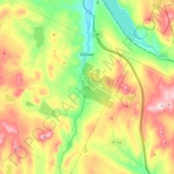
Name: Glover topographic map, elevation, terrain.
Location: Glover, Orleans County, Vermont, United States of America (44.62410 -72.31569 44.74405 -72.14596)
Average elevation: 1,542 ft
Minimum elevation: 850 ft
Maximum elevation: 2,382 ft