
Village of Schaghticoke topographic map
Interactive map
Click on the map to display elevation.
About this map
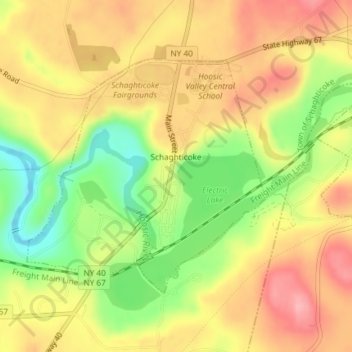
Name: Village of Schaghticoke topographic map, elevation, terrain.
Average elevation: 335 ft
Minimum elevation: 112 ft
Maximum elevation: 505 ft
Other topographic maps
Click on a map to view its topography, its elevation and its terrain.
Speigletown
United States > New York > Rensselaer County > Town of Schaghticoke
Speigletown, Town of Schaghticoke, Rensselaer County, New York, 12182, United States
Average elevation: 446 ft