
Senlac Hill topographic map
Interactive map
Click on the map to display elevation.
About this map
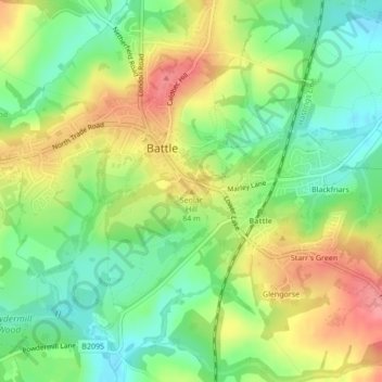
Name: Senlac Hill topographic map, elevation, terrain.
Average elevation: 203 ft
Minimum elevation: 75 ft
Maximum elevation: 364 ft
Other topographic maps
Click on a map to view its topography, its elevation and its terrain.
Quickbourne
United Kingdom > England > Rother > Northiam > Quickbourne
Quickbourne, Northiam, Rother, East Sussex, South East England, England, TN31 6QX, United Kingdom
Average elevation: 75 ft
Crowhurst Nature Reserve
United Kingdom > England > Rother
Crowhurst Nature Reserve, Sandrock Hill, Crowhurst, Rother, East Sussex, South East, England, TN33 9AT, United Kingdom
Average elevation: 85 ft