
Aratula topographic map
Interactive map
Click on the map to display elevation.
About this map
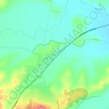
Name: Aratula topographic map, elevation, terrain.
Location: Aratula, Queensland, Australia (-28.00059 152.52826 -27.96059 152.56826)
Average elevation: 387 ft
Minimum elevation: 285 ft
Maximum elevation: 666 ft
Other topographic maps
Click on a map to view its topography, its elevation and its terrain.
Moogerah Peaks National Park
Australia > Queensland > Aratula
Moogerah Peaks National Park, Mt Edwards Summit, Aratula, Queensland, Australia
Average elevation: 702 ft