
Mount Ruapehu topographic map
Interactive map
Click on the map to display elevation.
About this map
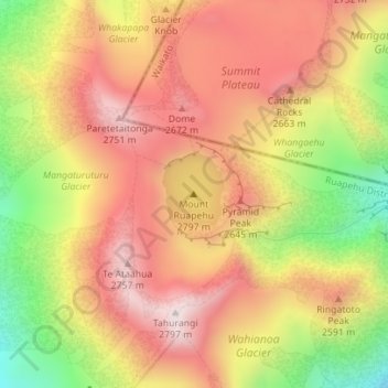
Name: Mount Ruapehu topographic map, elevation, terrain.
Average elevation: 8,117 ft
Minimum elevation: 6,814 ft
Maximum elevation: 9,039 ft
Ruapehu has a polar tundra climate (Köppen: ET) on the upper slopes, with average temperatures ranging from −4–15 °C in summer and −7–7 °C in winter, depending on elevation and cloudiness. On the lower slopes, Ruapehu has a subpolar oceanic climate (Köppen: Cfc).
Other topographic maps
Click on a map to view its topography, its elevation and its terrain.
Hunua
New Zealand > Manawatu-Whanganui > Ruapehu District
Hunua, Ruapehu District, Manawatū-Whanganui, New Zealand
Average elevation: 1,493 ft