
Mills River topographic map
Interactive map
Click on the map to display elevation.
About this map
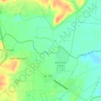
Name: Mills River topographic map, elevation, terrain.
Average elevation: 2,077 ft
Minimum elevation: 2,021 ft
Maximum elevation: 2,165 ft
Other topographic maps
Click on a map to view its topography, its elevation and its terrain.
Mills River
United States > North Carolina > Henderson County > Mills River > Oak Hill Court
Mills River, Oak Hill Court, Mills River, Henderson County, North Carolina, 28759, United States
Average elevation: 2,113 ft