
Loganville topographic map
Interactive map
Click on the map to display elevation.
About this map
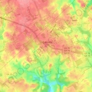
Name: Loganville topographic map, elevation, terrain.
Location: Loganville, Walton County, Georgia, United States (33.81132 -83.93729 33.86106 -83.86129)
Average elevation: 948 ft
Minimum elevation: 781 ft
Maximum elevation: 1,047 ft
Other topographic maps
Click on a map to view its topography, its elevation and its terrain.
Social Circle
United States > Georgia > Walton County
Social Circle, Walton County, Georgia, 30025, United States
Average elevation: 781 ft
Good Hope
United States > Georgia > Walton County
Good Hope, Walton County, Georgia, United States
Average elevation: 787 ft
Monroe
United States > Georgia > Walton County
Monroe, Walton County, Georgia, 30655, United States
Average elevation: 833 ft