
Hartwell topographic map
Interactive map
Click on the map to display elevation.
About this map
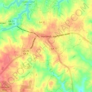
Name: Hartwell topographic map, elevation, terrain.
Location: Hartwell, Hart County, Georgia, United States (34.31856 -82.95805 34.37518 -82.89979)
Average elevation: 748 ft
Minimum elevation: 630 ft
Maximum elevation: 846 ft
Other topographic maps
Click on a map to view its topography, its elevation and its terrain.
Cross Roads
United States > Georgia > Hart County
Cross Roads, Hart County, Georgia, 30516, United States
Average elevation: 860 ft