
Lake William topographic map
Interactive map
Click on the map to display elevation.
About this map
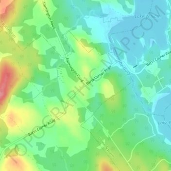
Name: Lake William topographic map, elevation, terrain.
Average elevation: 354 ft
Minimum elevation: 259 ft
Maximum elevation: 545 ft
Other topographic maps
Click on a map to view its topography, its elevation and its terrain.
Barss Corner
Canada > Nova Scotia > Barss Corner
Barss Corner, Municipality of the District of Lunenburg, Lunenburg County, Nova Scotia, B0R 1E0, Canada
Average elevation: 387 ft