
Bener Meriah topographic map
Interactive map
Click on the map to display elevation.
About this map
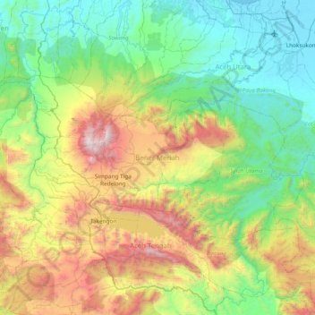
Name: Bener Meriah topographic map, elevation, terrain.
Location: Bener Meriah, Aceh, Indonesia (4.57760 96.57593 4.97020 97.32872)
Average elevation: 2,608 ft
Minimum elevation: -3 ft
Maximum elevation: 9,337 ft